X-Eye aircraft & payload
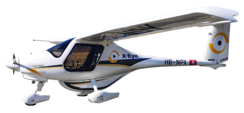
The X-Eye platform
The X-Eye aircraft, a modified EASA Certified Pipistrel Explorer, is equipped with a cargo pod that can carry up to 40 kg of equipment, installed in the most efficient light aircraft on the market. Not only does low fuel consumption drive the operating cost down but featuring a ballistic rescue system and a stunning glide ratio make it very safe to complete your aerial work.
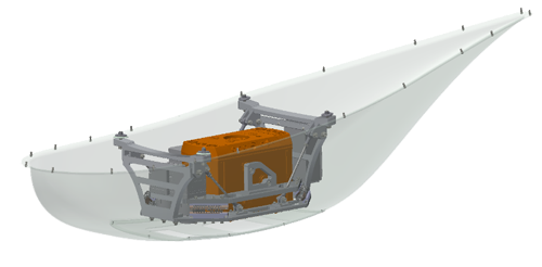
X-Eye payload bay
The X-Eye belly-pod protects the sensor gear which is mounted onto a modular rack that can hold up to 40kg. The rack absorbs the vibrations and shocks making superb data quality reality.
Application
-

Powerline inspection
Aerial LiDAR data provides everything required to survey transmission lines. Vegetation managements, measure the topography, measure the sag on wires, and much are available in a timely fashion at low operational costs. -
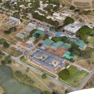
3D city modelling
Create 3D city models with aerial cameras in an oblique position for a greater image coverage and capture of façade data. Installed on an X-Eye this solution becomes affordable even for smaller cities and communes. -

Precision agriculture
Water management, analysing the state of health of your crops throughout the season, drainage monitoring etc. all that and more is possible with the X-Eye Solution that combines RGB and multispectral data. -

Environmental mapping
Glacier monitoring, thermal inspections, tree counting for improved forestry management, hydrography and topography for flood and storm water management.